MISSION STATEMENT: TO MANAGE,
AUGMENT, AND PROTECT WATER RESOURCES FOR THE BENEFIT OF THE
COMMUNITY AND THE ENVIRONMENT
Welcome to the Monterey Peninsula
Water Management District GIS Map Gallery. This gallery contains a few
examples of GIS projects the District is developing. Please read the disclaimer
associated with these maps and figures.
Click on a thumbnail image to view a larger copy of the map or figure.
To download a .pdf version right-click on the appropriate "download
pdf" link and choose "Save Target As.."
Check the file size BEFORE downloading an
image. Many of the maps were produced at large scale (34" X
44") and can be greater than 10 Mb in size.
** If users have a dial-up connection, it is
recommended that the users view the Thumbnail Image version and download
the PDF file. For dial-up connections, estimated times for download
are listed next to the PDF document hyperlink.**
Please fill out a survey for the MPWMD Map Gallery: Comment
form
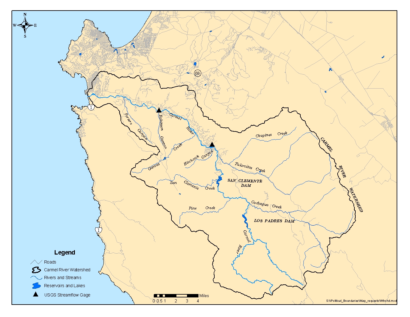
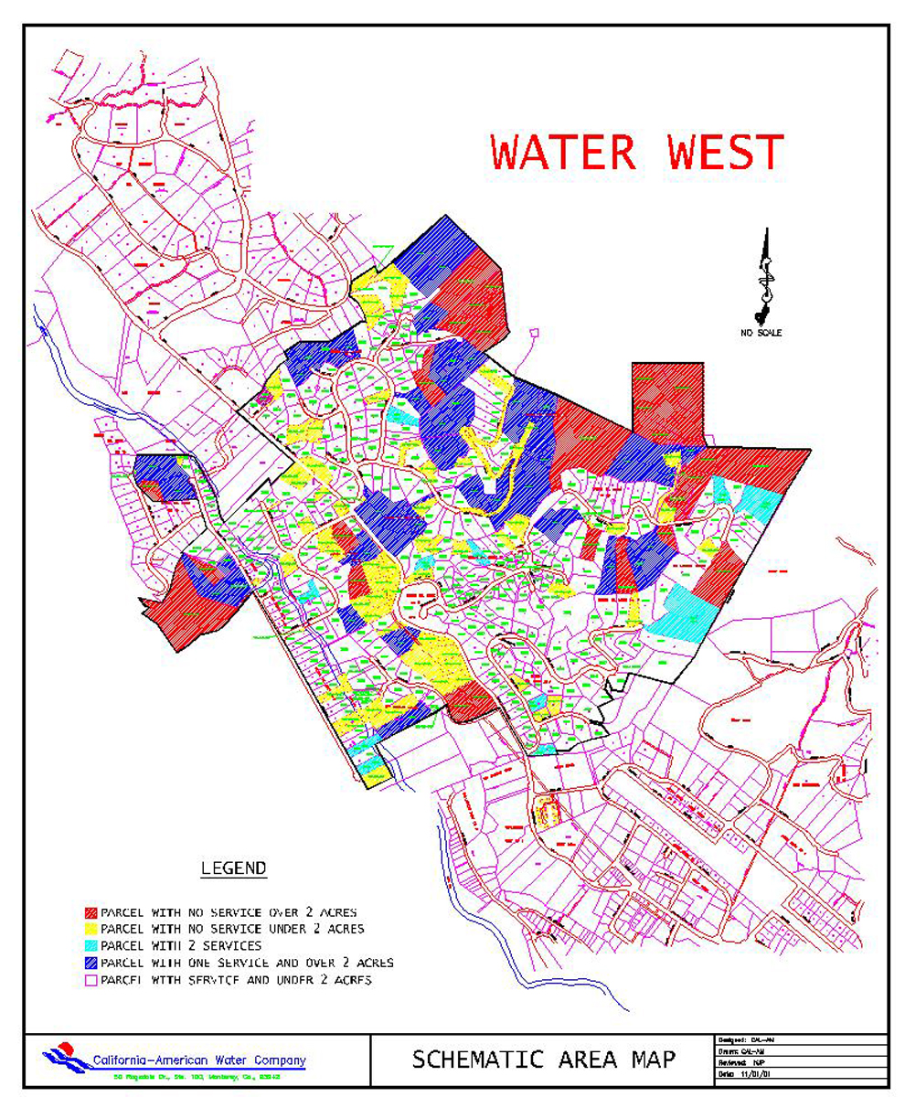
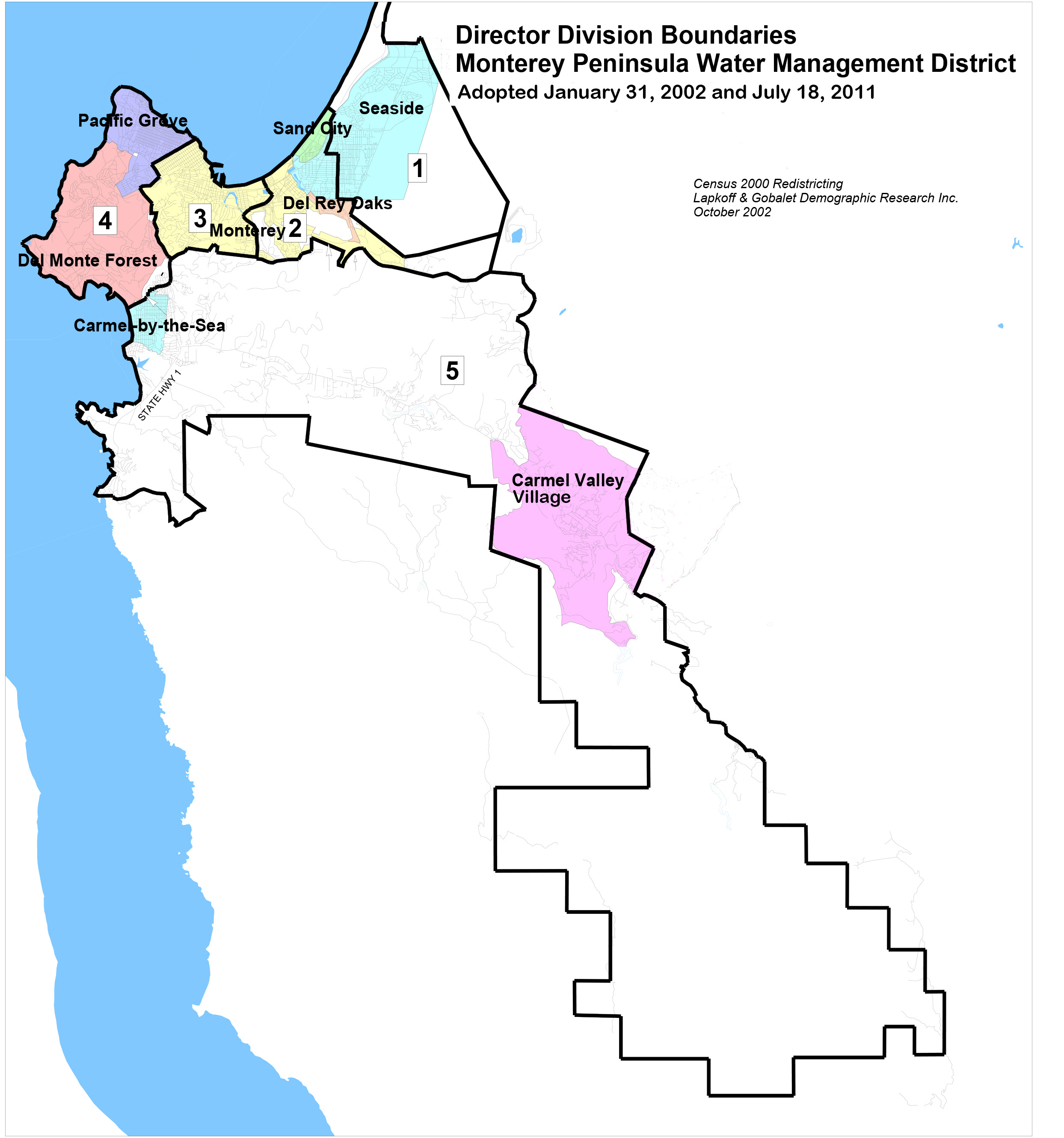
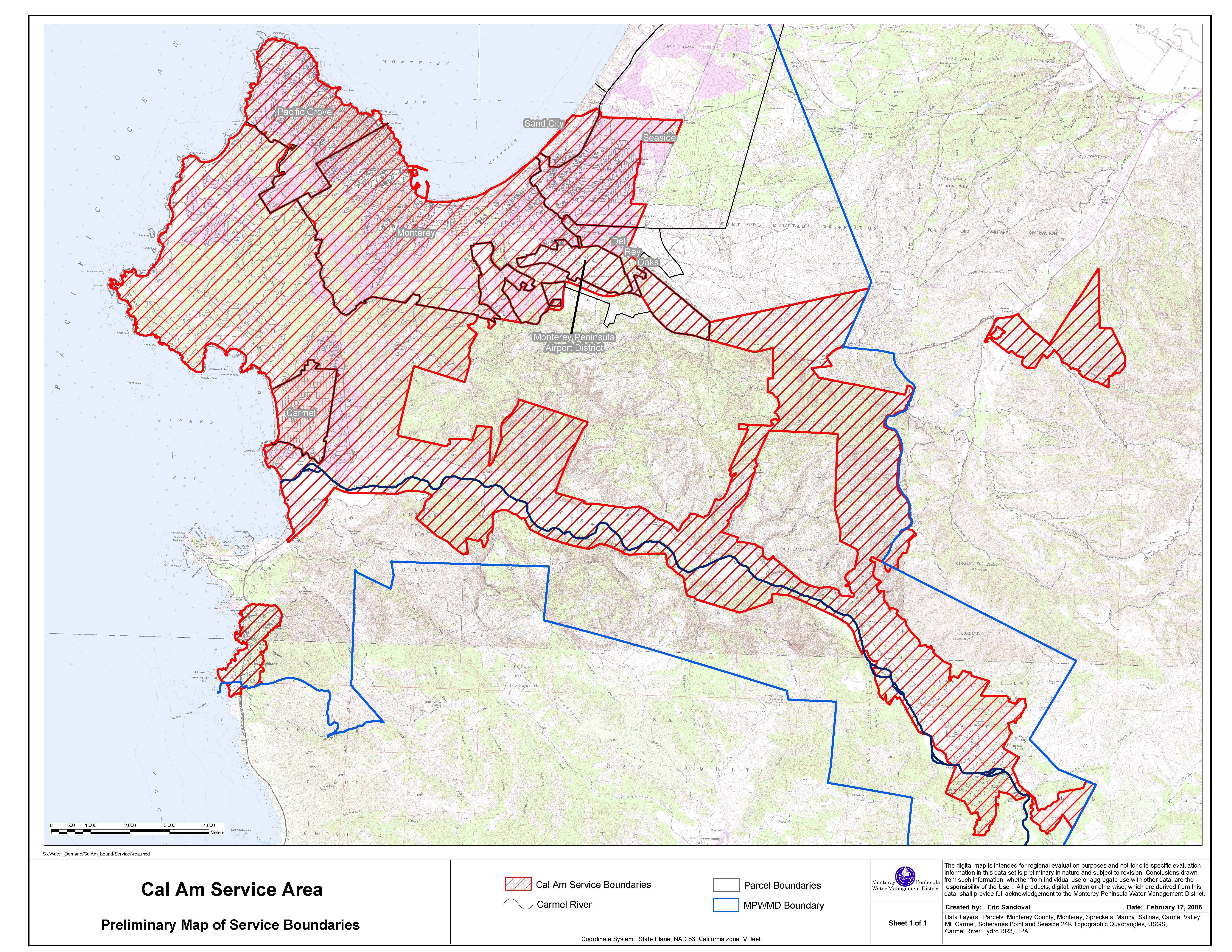
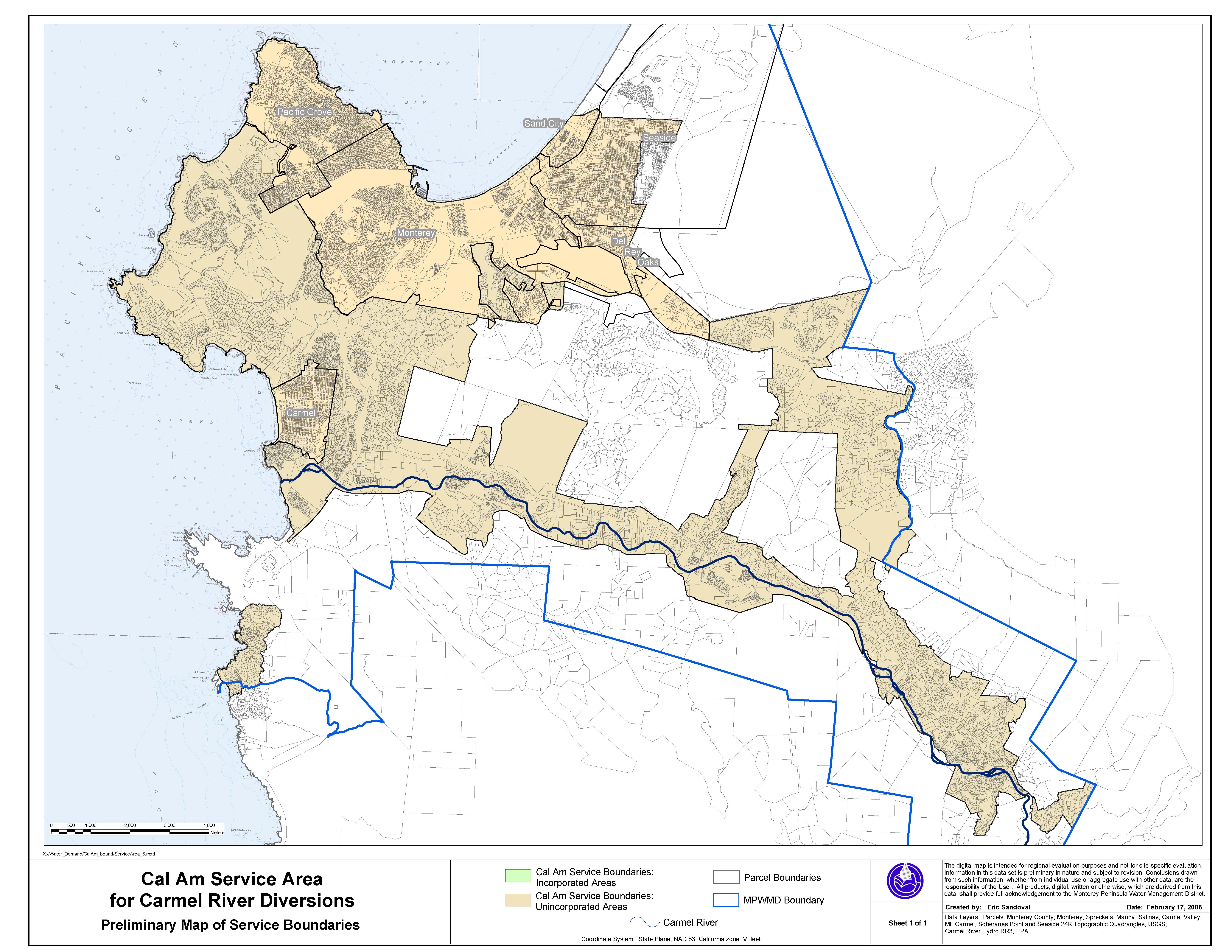
Thumbnail Image
Title
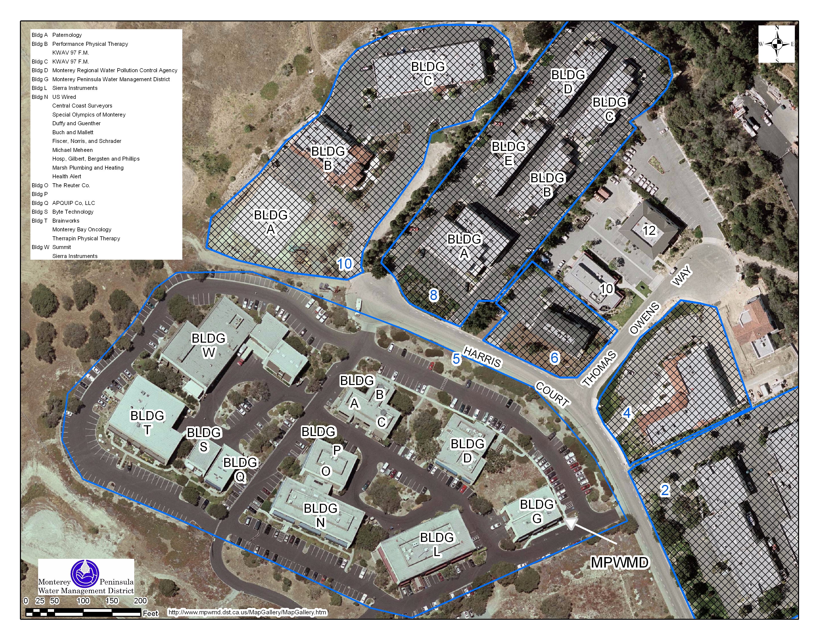
Location Map of Monterey
Peninsula Water Management District office within Ryan Ranch. Download pdf (4.1 Mb)