|
Thumbnail Image
|
Map
Descriptions
|
|
|
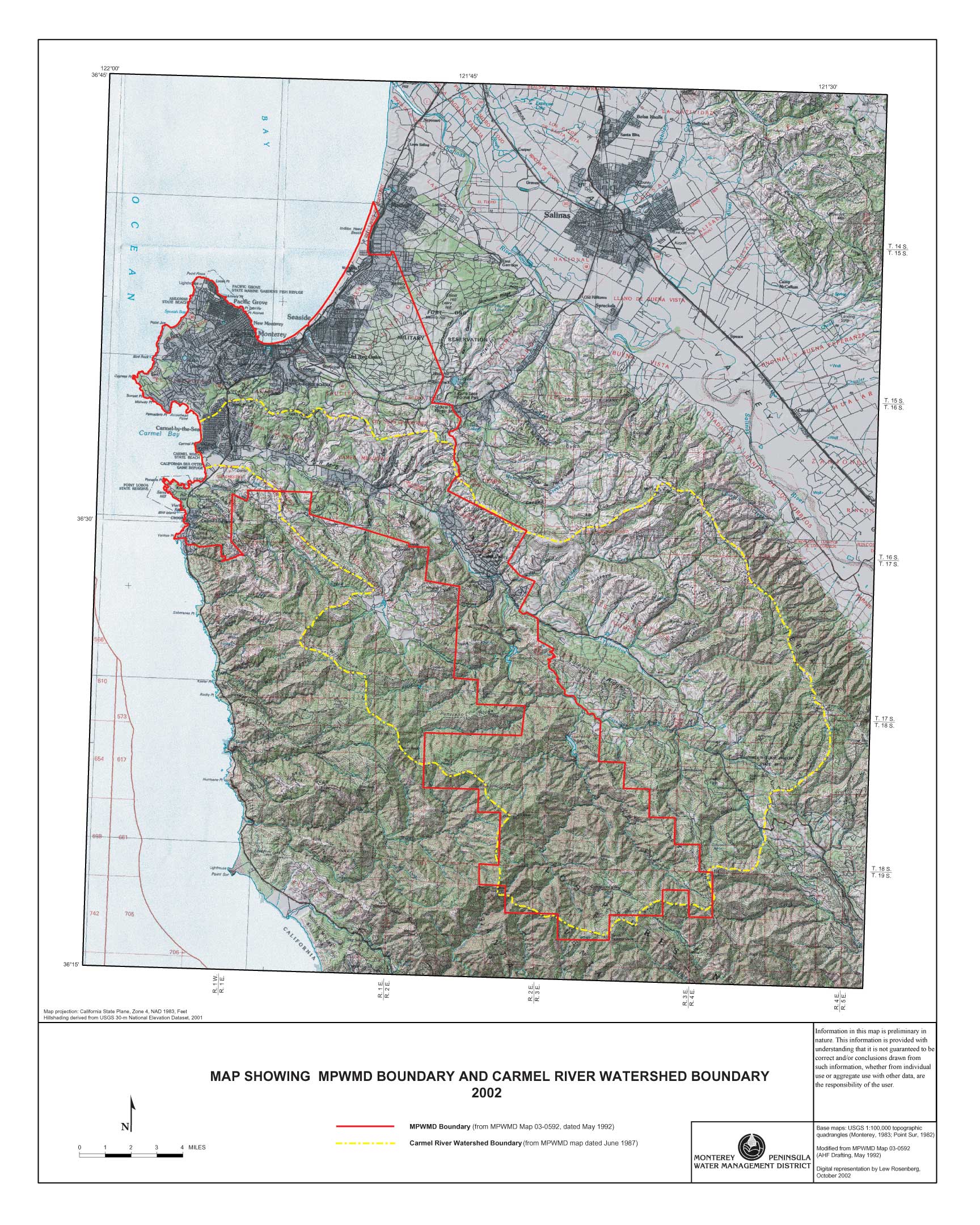
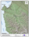
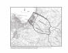
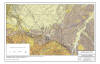
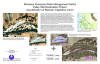
Title: Monterey Peninsula
Water Management District boundary and Carmel River Watershed boundary
Abstract: This map contains
a digital raster graphic topographic base map of the Monterey Peninsula
Water Management District (MPWMD) regulatory area at 1:100,000 scale.
It was derived from georeferenced, scanned image of the MPWMD regulatory
boundary and USGS topographic base map. Shaded relief was derived
from the USGS 30-meter digital elevation model.
Purpose: To provide a visual
representation of the MPWMD and the Carmel River watershed boundary in
relation to the USGS topographic quadrangle base map.
|
|
|
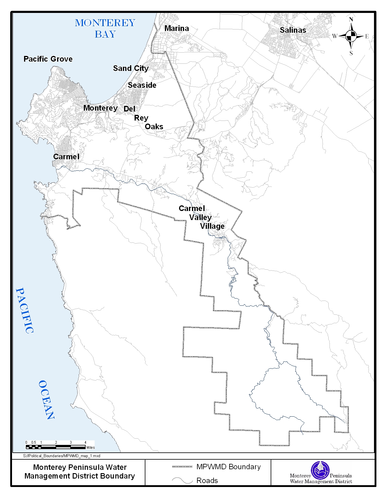
Title: Monterey Peninsula
Water Management District boundary
Abstract: This map contains
a digital raster graphic base map of the Monterey Peninsula Water
Management District (MPWMD) regulatory area at approximately 1:125,000
scale. It was derived from COGO representation of the written
description as outlined in the State Water Code Appendix 118-102, Chapter
1: Creation and Territory.
Purpose: To provide a visual
representation of the MPWMD Boundary for general presentations and
reports
|
|
|
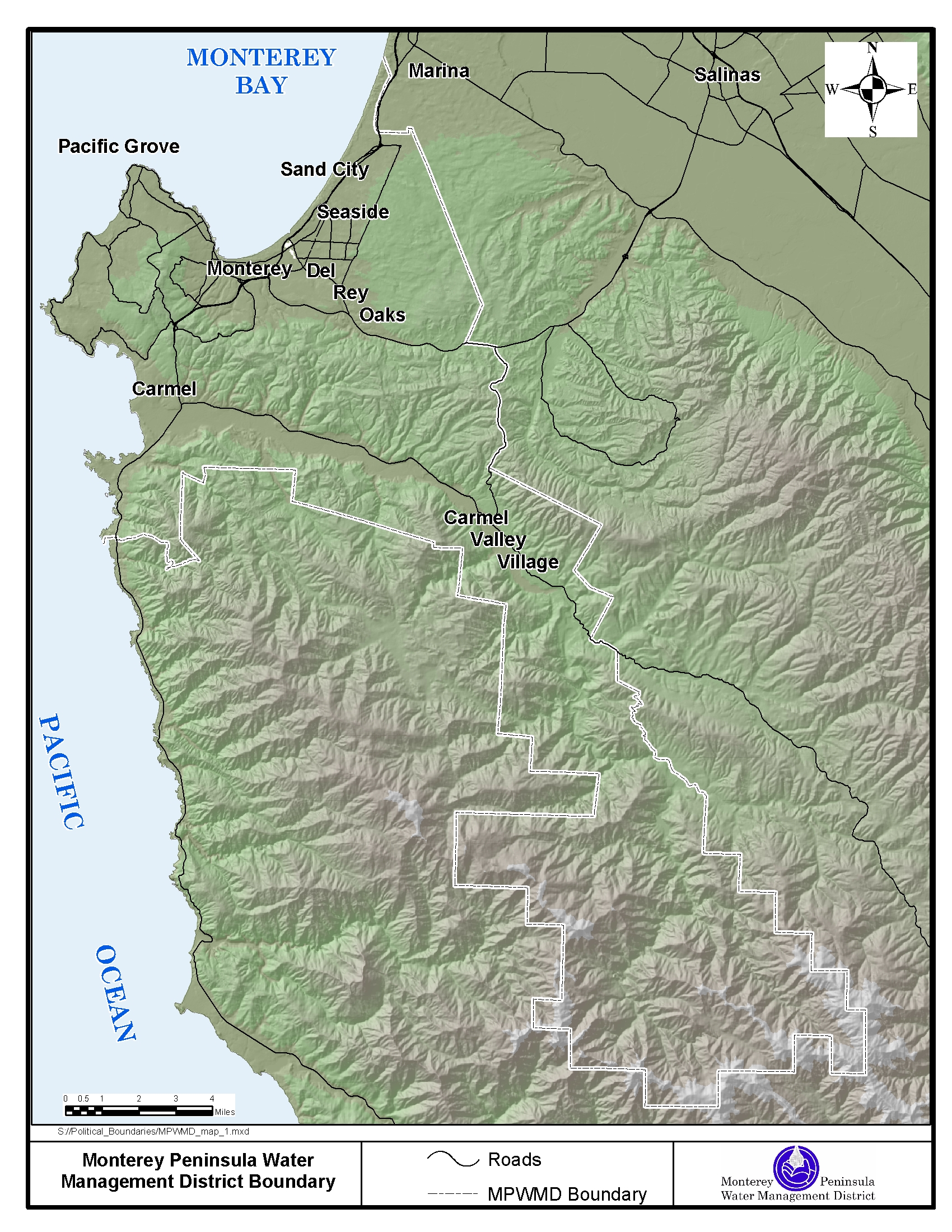
Title: Monterey Peninsula
Water Management District boundary
Abstract: This map contains
a digital raster graphic base map of the Monterey Peninsula Water
Management District (MPWMD) regulatory area at approximately 1:125,000
scale. It was derived from COGO representation of the written
description as outlined in the State Water Code Appendix 118-102, Chapter
1: Creation and Territory. Shaded relief was derived from the USGS
30-meter digital elevation model.
Purpose: To provide a visual
representation of the MPWMD Boundary for general presentations and
reports
|
|
|
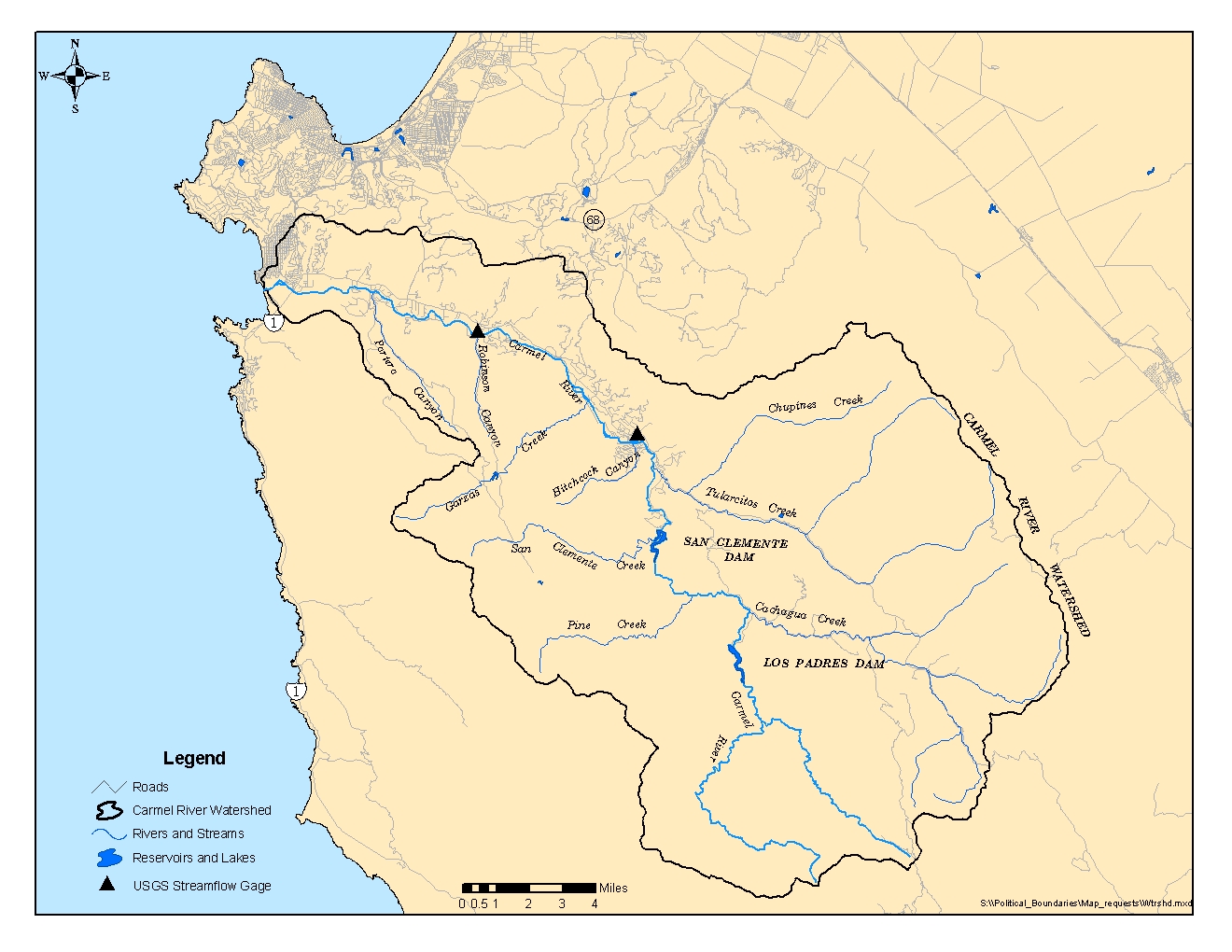
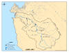
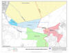
Title: Carmel River
Watershed boundary
Abstract: The Carmel River
Watershed boundary is based upon the California Watershed Map. The
California Watershed Map(CALWATER version 2.2)
is a set of standardized watershed boundaries meeting standardized
delineation criteria. The hierarchy of watershed designations consists of
six levels of increasing specificity: Hydrologic Region (HR), Hydrologic
Unit (HU), Hydrologic Area (HA), Hydrologic Sub-Area (HSA), Super
Planning Watershed (SPWS), and Planning Watershed (PWS).
Purpose: The primary purpose
of Calwater is the assignment of a single,
unique code to a specific watershed polygon. The purpose of this map is
to provide a visual representation of the Carmel River Watershed boundary
for general presentations and reports
|
|
|
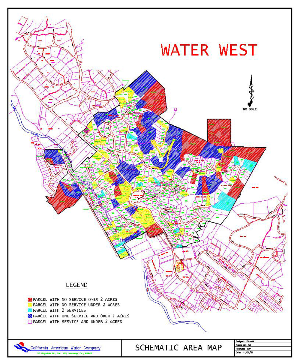
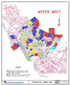
Title: Water West
Map: Former water system for Carmel Valley Residents
Abstract: Properties located
in the former Water West system, now owned and operated by
California-American Water Company (Cal-Am), are eligible for water from
the Water
West Allocation. There is a limited amount of water
available (12.473 acre-feet as of July 28, 2003). The area is
generally located between Phelps Way and Laurel Drive on the North and
South sides of Carmel Valley Road in Carmel Valley, California. The
map of the former Water West service area was provided by Cal-Am Water
Company and may not contain all parcels located within the former Water
West area. If you have copies of water bills from the former Water
West system and your property is not included in the mapped area, please
submit copies to Monterey County Planning and Building Inspection
Department as evidence of your eligibility for water.
Purpose: To provide a visual
representation of the former Water West water system service area.
The map of the former Water West service area was provided by Cal-Am
Water Company and may not contain all parcels located within the former
Water West area. Click HERE
for a link to more detailed information.
|
|

|
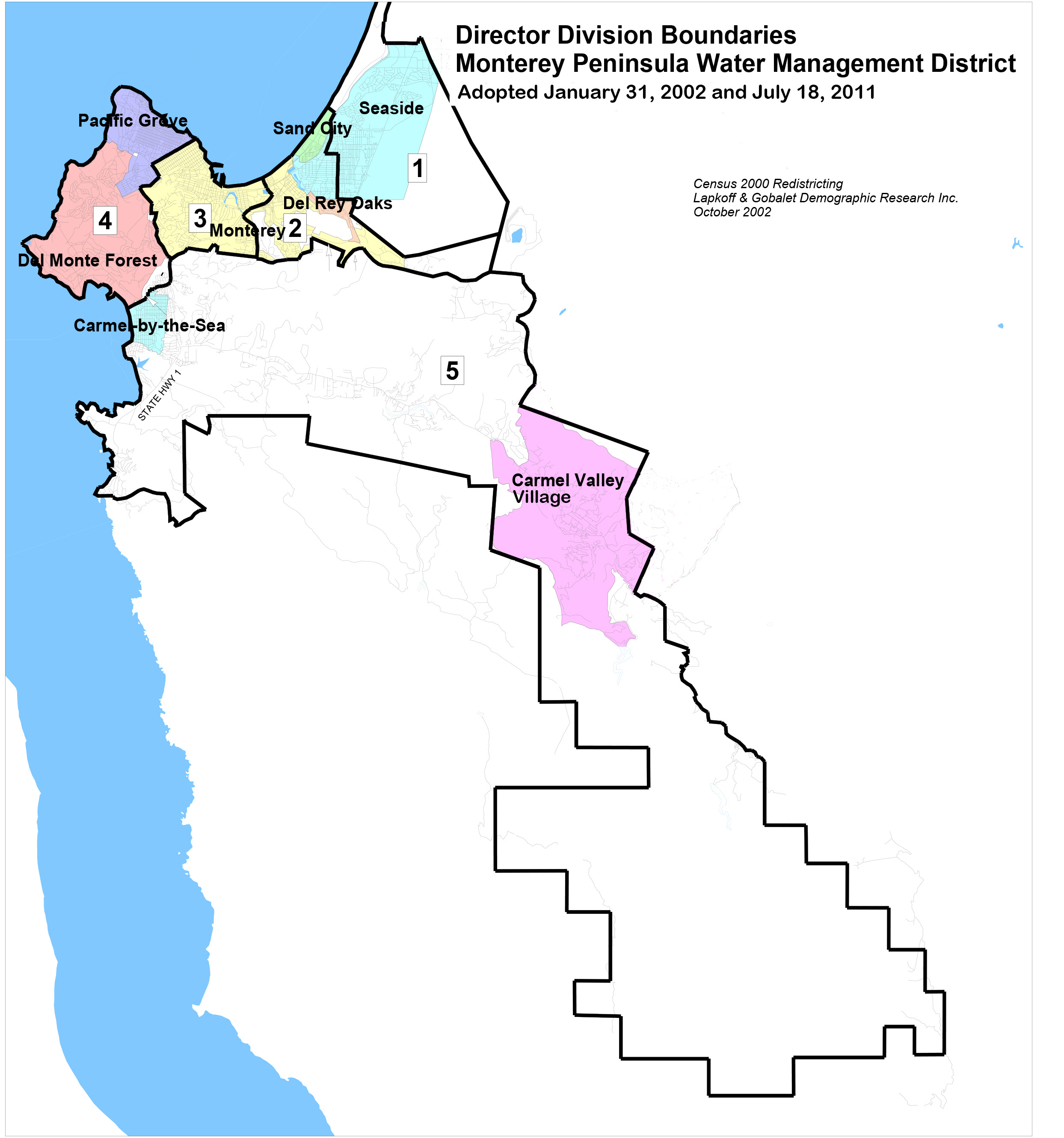
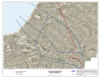
Title: Voter Division
Boundary Maps
Abstract: During the Census
2000 Redistricting effort the boundaries for 5 voter divisions of the
Monterey Peninsula Water Management District were drawn and a map was
created to visualize these boundaries. Each map shows the geographical
divisions of the voting districts for each of the 5 MPWMD representatives
that are elected by voter division. The voter divisions were
adopted by the Board of Directors in January 2002, precleared by the U.S.
Department of Justice in July 2002, and adopted again by the Board
without amendment in July 2011. The Monterey County Board of Supervisors
appoints a representative to the Board, as does a committee comprised of
mayors from jurisdictions within the District boundaries.
Purpose: To provide a visual
representation of the MPWMD board member voting districts.
|
|
|
Title: Monterey Peninsula
Water Management District boundary and County of Monterey Parcel Map:
Ordinance 105 Maps
Abstract: This map series
contains 14 maps and 1 index map that cover the Monterey Peninsula Water
Management District (MPWMD) boundary and Carmel River watershed
boundary. The maps were derived from numerous sources of data, some
of which include: MPWMD boundary, Carmel River Alluvial Aquifer, Monterey
County Township and Range boundaries, Monterey County street centerlines,
Monterey County parcel boundaries, Cal-EPA River Reach 3 streams and
rivers, Carmel River watershed boundary, and Monterey Peninsula city
limits.
Purpose: Provide a visual
representation of relevant boundaries associated with Monterey Peninsula
Water Management District Ordinance 105. This map is used by MPWMD
staff to help determine whether Ordinance 105 pertains to a particular
parcel or legal lot of record
|
|
|
Title: Seaside Basin
boundary Map
Abstract: This map contains
a boundary that delineates the Seaside Groundwater Basin. The
boundaries were derived from the 2005 Seaside Basin Report
Purpose: Provide a visual
representation of relevant boundaries associated with Seaside Groundwater
Basin. This map is used by MPWMD staff for basin management,
groundwater modeling and hydrogeology analysis.
|
|
|
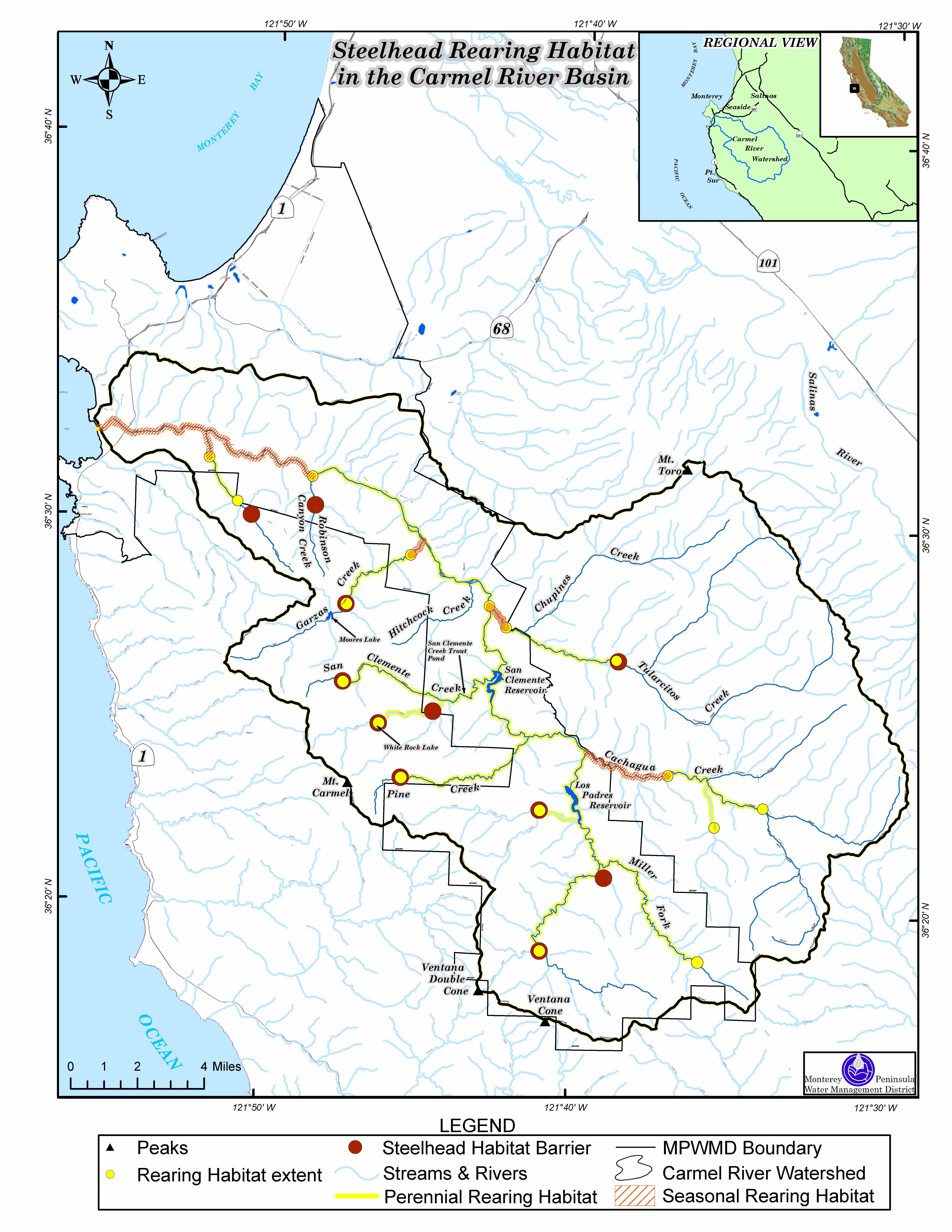
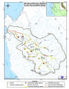
Title: Steelhead Rearing
Habitat Map
Abstract: This map contains
features that depict seasonal steelhead rearing habitat. The
features were derived from the USGS hydrography layer,
that consists of flowing waters (rivers and streams), standing
waters (lakes and ponds), and wetlands -- both natural and
manmade. Line features have attribute codes that represent
streams or shorelines. The hydrography layer was assembled from
data originally published by the U.S. Geological Survey (USGS) in Digital
Line Graph (DLG-3) format. DLG-3 data were generated by USGS from
1:100,000-scale maps by manual digitizing and raster scanning.
Reaches were identified from the hydrography layer that contained
potential steelhead habitat. A 1000-ft buffer was created that
outlines the seasonal rearing habitat as defined by Monterey Peninsula
Water Management District surveys and historical observations.
Purpose: Provide a visual
representation of relevant steelhead rearing habitats in the Carmel River
Watershed.
|
|
|
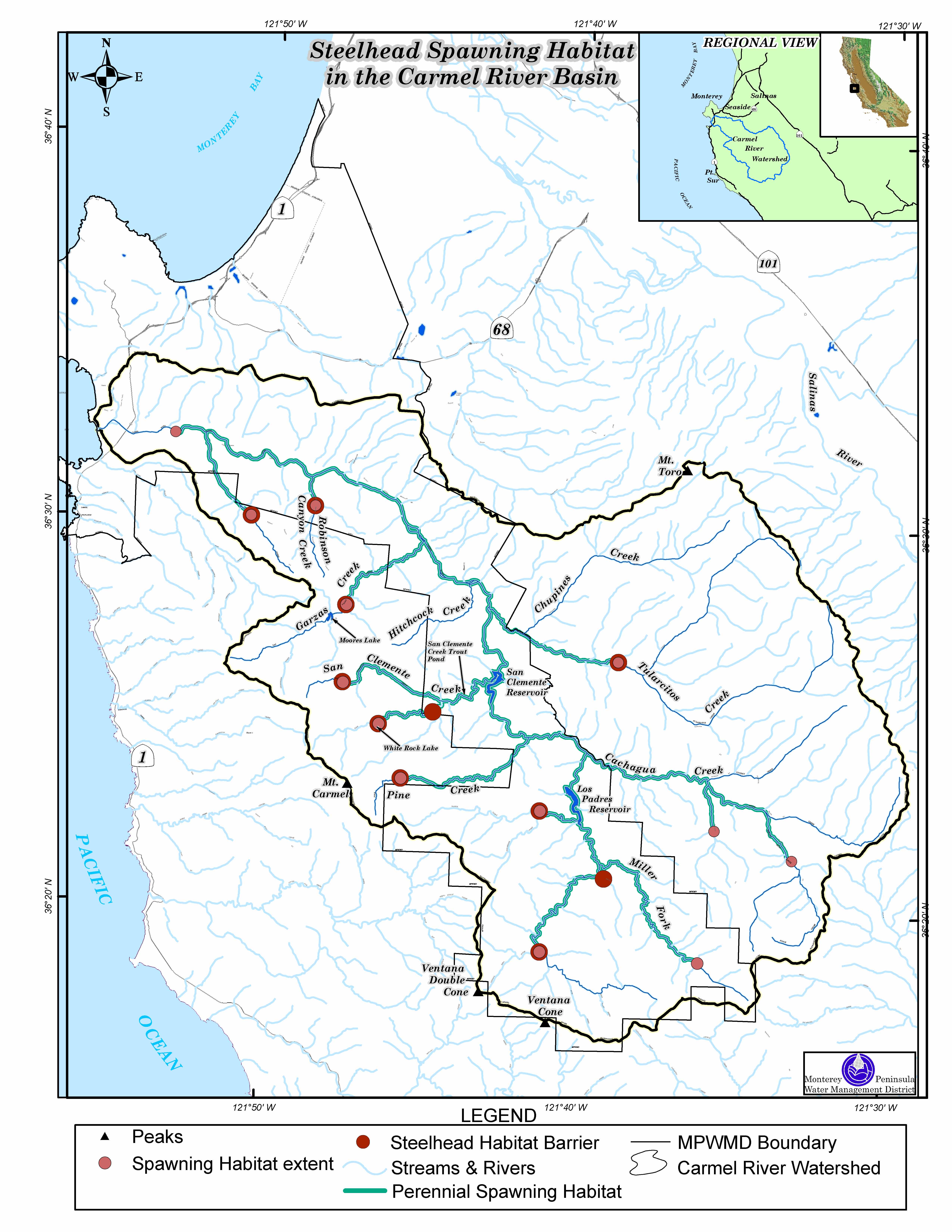
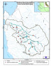
Title: Steelhead Spawning
Habitat Map
Abstract: This map contains
features that depict seasonal steelhead spawning habitat. The
features were derived from the USGS hydrography layer,
that consists of flowing waters (rivers and streams), standing
waters (lakes and ponds), and wetlands -- both natural and
manmade. Line features have attribute codes that represent
streams or shorelines. The hydrography layer was assembled from data
originally published by the U.S. Geological Survey (USGS) in Digital Line
Graph (DLG-3) format. DLG-3 data were generated by USGS from
1:100,000-scale maps by manual digitizing and raster scanning.
Reaches were identified from the hydrography layer that contained potential
steelhead habitat. A 1000-ft buffer was created that outlines the
seasonal spawing habitat as defined by Monterey
Peninsula Water Management District surveys and historical observations.
Purpose: Provide a visual
representation of relevant steelhead rearing habitats in the Carmel River
Watershed.
|
|
|
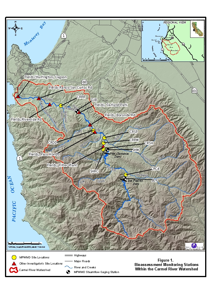
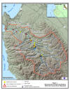
Title: Benthic
Macroinvertebrate Bioassessment Sample Sites
Map
Abstract: The Monterey
Peninsula Water Management District initiated a biological monitoring
program for the Carmel River in the fall of 2000 to help evaluate its
water and physical habitat quality and establish a baseline of
information. This information will be used in conjunction with other
water quality assessment programs to assess effects of future land and
water use activities. District staff recognized that monitoring of
aquatic benthic macroinvertebrates could supplement and complement their
ongoing surface water quality sampling.
Purpose: Because of benthic
macroinvertebrate (BMI) abundance, taxonomic diversity and range of
response to changes in their aquatic environment, BMI were used to monitor
the quality of surface water resources. These sites help MPWMD
staff monitor water and habitat quality.
|
|
|
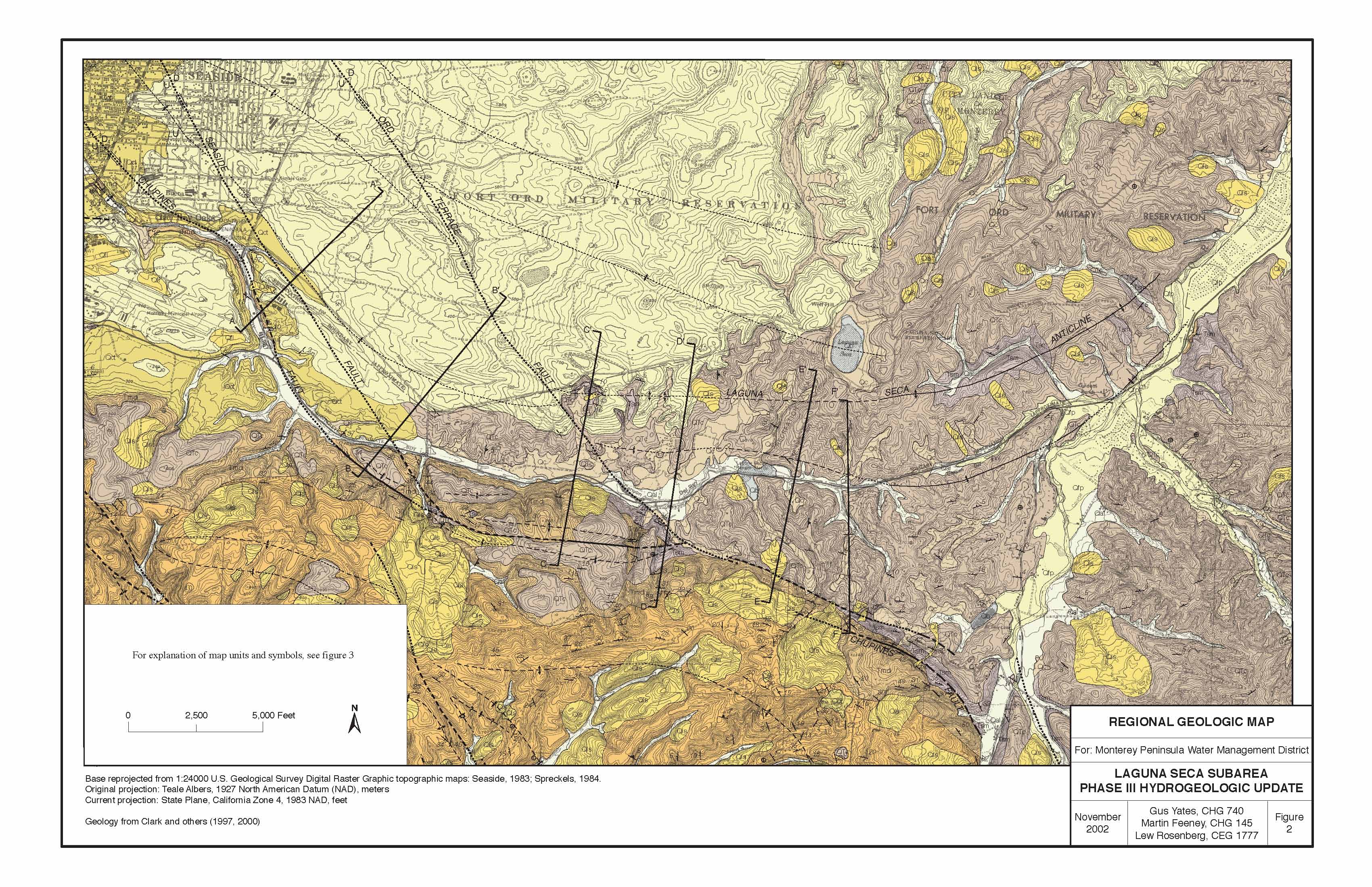
Title: Laguna Seca Subarea Geology
Map
AND
Title: Laguna Seca Subarea Geologic Unit
Description
Abstract: Under
Construction
Purpose: Under
Construction
|
|
|
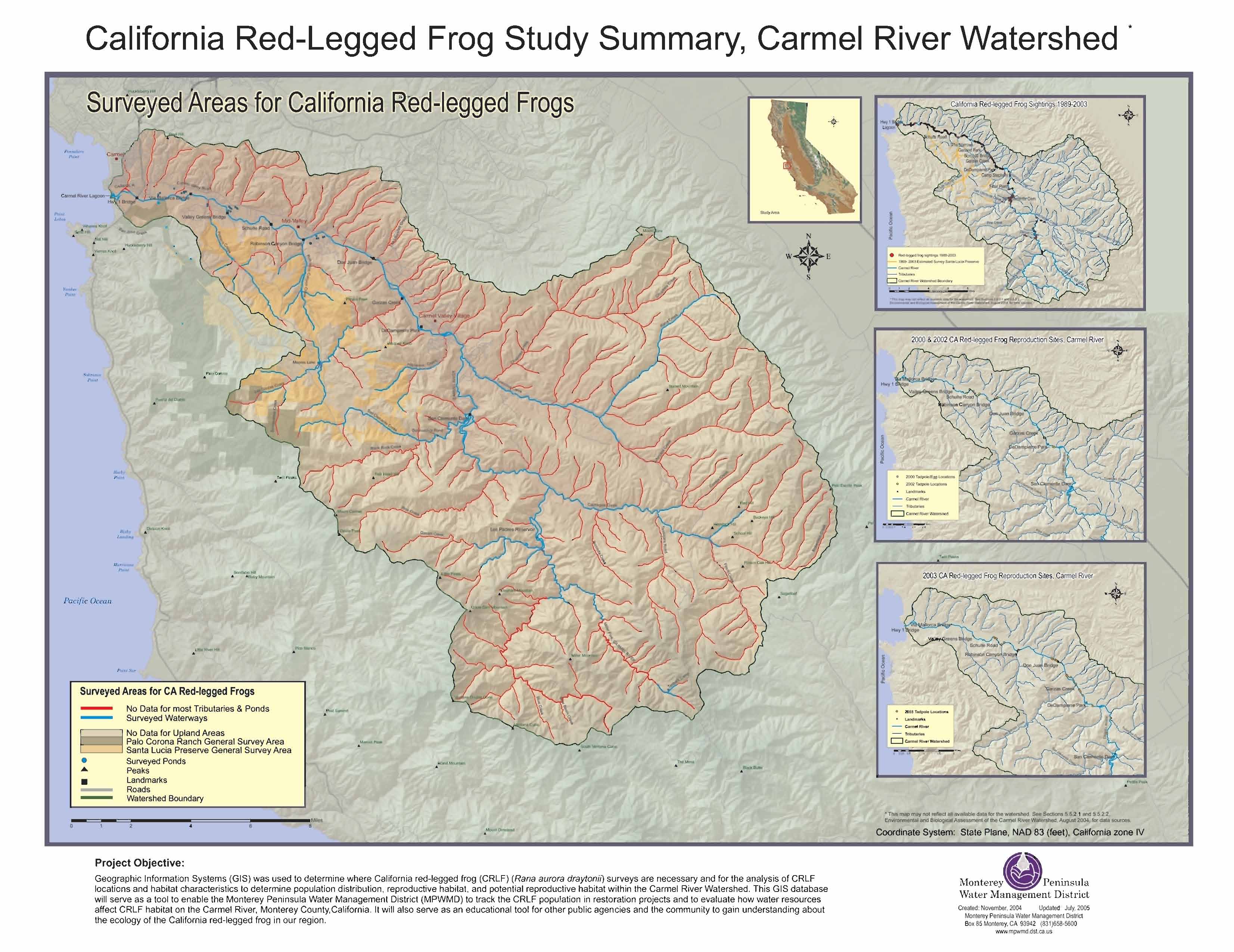
Title: Red Legged Frog
Sightings Map
Abstract: Geographic
Information Systems (GIS) was used to determine where California
red-legged frog (CRLF) Rana aurora draytonii
surveys are necessary and for the analysis of CRLF locations and
habitat characteristics to determine population distribution, reproductive
habitat, and potential reproductive habitat within the Carmel River
Watershed. Data from MPWMD, Calif. Dept. of Fish and Game and other
sources were used to compile the sighting locations.
Purpose: This GIS
database will serve as a tool to enable the Monterey Peninsula Water
Management District (MPWMD) to track the CRLF population in restoration
projects and to evaluate how water resources affect CRLF habitat on the
Carmel River, Monterey County,California.
It will also serve as an educational tool for other public agencies and
the community to gain understanding about the ecology of the California
red-legged frog in this region.
|
|
|
Title:
Cross Section For a HDD Well: Desalination Project Diagram
Abstract:
Purpose:
|
|
|
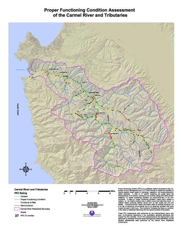
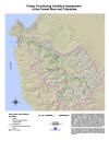
Title: Proper Functioning
Condition Assessment of The Carmel River and Tributaries
Abstract: Proper functioning
condition (PFC) is a qualitative method developed by the U.S. Bureau of
Land Management and U.S. Forest Service to assess the condition of
riparian-wetland areas based on hydrology, vegetation, and
erosion/deposition (soils) attributes. A total of 17 “yes/no” questions
are posed about the characteristics of the stream, resulting in one of
three ratings that reflect stream resiliency: (1) proper functioning
condition; (2) functional-at-risk; or (3) non-functional. A rating of
“proper functioning condition” means that a stream is resilient, i.e.,
the riparian-wetland area is stable during most high-flow events. A
resilient stream produces desired values such as high quality fish and
bird habitat. “Functional-at-risk” means the stream reach is currently
functional, but is at risk of becoming non-functional due to an observed
condition that could impact the reach in the future. “Non-functional”
indicates that there is a condition in the reach or watershed interfering
with the natural functions of the stream. These PFC assessments
were performed by two interdisciplinary teams with local, on-the-ground
experience in the quantitative sampling techniques that support the PFC
checklist. The 37 PFC assessments for the Carmel River were performed by
Monterey Peninsula Water Management District (MPWMD), and 95 tributary
assessments were performed by the Carmel River Watershed Conservancy.
Purpose: To evaluate the
functioning condition of the Carmel River and associated tributaries in
the Carmel River watershed
|
|
|
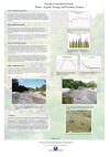
Title:
Valley Hills Restoration Project: Quantification of Riparian
Vegetative Cover
Abstract: In 1984, the
Monterey Peninsula Water Management District (MPWMD) developed the Carmel
River Management Plan to address erosion, property loss, and the decline
of Carmel River habitat. Primary goals included the protection of aquatic
and riparian resources within the alluvial portion, and comprehensive stream
restoration using a combination of limited structural protection and
native riparian plants. In 1984, restoration of eight miles of river was
scheduled to be completed by MPWMD within ten years. In 1992 and 1993,
the restoration of the Valley Hills reach was completed and has since
been irrigated. Two aerial photos, taken in July 1991 and July 2003, were
spatially corrected and used to track changes in vegetation development.
The results show that in 1991, prior to the restoration effort, 1.44 acres
of riparian vegetation existed within the total project area of 5.63
acres (26% cover). Twelve years later, after re-contouring of the site
and the planting of cottonwoods, willows, alders, and dogwoods, a total
of 4.10 acres of riparian vegetation exist. This is 73% cover, showing a
185% increase in riparian vegetation in this reach.
Purpose: Quantify the change of vegetative cover of the Valley Hills
Restoration site, using remote sensing and GIS.
|
|
|
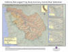
Title:
Laguna Seca Subarea and Regional Water
Systems
Abstract: Under
Construction
Purpose: Provide a
visualization of the Laguna Seca subarea
boundary and regional water systems boundaries in relation to parcel and
street location overlay.
|
|
|
Title:
Seaside Groundwater Basin and Subareas
Abstract: Under
Construction
Purpose: Provide a
visualization of the Seaside Groundwater Basin and subarea boundaries in
relation to 2003 Orthoimagery and MPWMD
boundary
|
|
|
Title:
POSTER- Seaside Groundwater Basin Phase 1 Aquifer Storage and Recovery
Project, Panel 1
Abstract: In the Monterey
Peninsula area, surface and groundwater resources are managed by the
Monterey Peninsula Water Management District (District). The District
regulates all water distribution systems within its boundaries.
California American Water (Cal-Am) owns and operates the largest
distribution system within the District and serves approximately 95% of
the water users in the area. Cal-Am produces water from wells in the
Carmel Valley alluvial groundwater basin and the Seaside groundwater
basin. Although these basins are hydrologically separate, they are
hydraulically connected by Cal-Am's
distribution system. Both basins are presently stressed from excessive
pumping. To help address these problems, the District has proposed
a phased Aquifer Storage and Recovery (ASR) Program that would divert
water from the Carmel Valley alluvial groundwater basin during the
high-flow rainy season for injection into the coastal subareas of the
Seaside groundwater basin. This water, which would be treated and
transmitted through the existing Cal-Am distribution system, would be
extracted by dual-purpose injection/recovery wells to meet Cal-Am
customer demand during the low-flow dry season.
Purpose: This poster was created for the 2005 ACWA conference. It
describes the Seaside Groundwater Basin Phase 1 Aquifer Storage and
Recovery Project. This poster is panel 1 of 2.
|
|
|
Title:
POSTER- Seaside Groundwater Basin Phase 1 Aquifer Storage and Recovery
Project, Panel 2
Abstract: In the Monterey
Peninsula area, surface and groundwater resources are managed by the Monterey
Peninsula Water Management District (District). The District regulates
all water distribution systems within its boundaries. The
District has proposed a phased Aquifer Storage and Recovery (ASR) Program
that would divert water from the Carmel Valley alluvial groundwater basin
during the high-flow rainy season for injection into the coastal subareas
of the Seaside groundwater basin. This water, which would be treated and
transmitted through the existing Cal-Am distribution system, would be
extracted by dual-purpose injection/recovery wells to meet Cal-Am
customer demand during the low-flow dry season
Purpose: This poster was
created for the 2005 ACWA conference. It describes the Seaside
Groundwater Basin Phase 1 Aquifer Storage and Recovery Project's purpose,
project yield, benefits and costs. This poster is panel 2 of 2
|
|
|
|